


New Zealand Topo Maps
Опис програми New Zealand Topo Maps
Простий у користуванні додаток для навігації на вулиці з останніми топографічними картами Нової Зеландії, островів Кука та Токелау.
Ця програма надає вам подібні варіанти картографування, як ви могли знати з портативних комп'ютерів Garmin або Magellan GPS.
Основні характеристики зовнішньої навігації:
• Створення та редагування шляхових точок
• Навігація GoTo-Waypoint
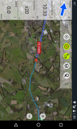
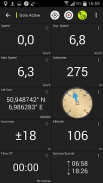
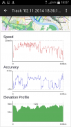
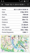
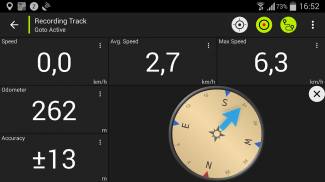
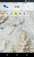
• Запис треку (зі швидкістю, висотою та точністю профілю)
• Tripmaster з полями одометра, середньої швидкості, підшипника, висоти тощо.
• GPX-імпорт / експорт, KML-експорт
• Пошук (назви точок, POI, вулиці)
• Настроювані поля даних у перегляді карт та Tripmaster (наприклад, швидкість, відстань, компас, ...)
• Ділитися шляховими точками, доріжками або маршрутами (через електронну пошту, Facebook, ..)
• Використовуйте координати в UTM, WGS84 або MGRS
• та багато іншого ...
Наявні базові шари карти:
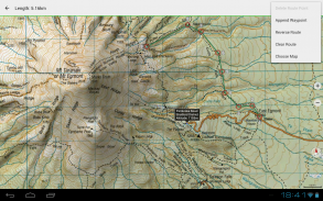
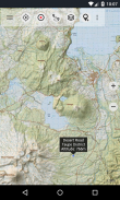
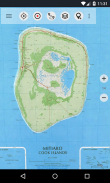
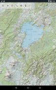
• Topomaps Нова Зеландія (безшовне покриття в масштабах 1: 250 000 та 1: 50 000)
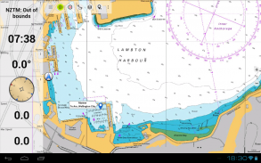
• NZMariner (морські карти RNC)
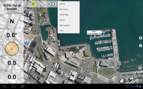
• Повітряні знімки LINZ
• Карти Google (супутникові зображення, дорожні та місцеві карти)
• Відкрийте Карти вулиць
• Bing Maps
• Карти ESRI
Накладення шарів:
• Зони охорони населення
• Відкриті мисливські зони
• Сайти DOC
• Обмеження DOC Freedom Camping
• Хати DOC
• DOC TRacks
• Рибальський район Таупо Форелі
• Холдинг
Використовуйте цю навігаційну програму для занять на свіжому повітрі, наприклад, походи, велосипеди, кемпінг, альпінізм, їзда на лижах, катання на каное або позашляхові 4WD тури.
Завантажте БЕЗКОШТОВНІ дані карт для областей без обслуговування стільникових. (Тільки для Pro версії)
ОБМЕЖЕННЯ БЕЗКОШТОВНОЇ ВЕРСІЇ:
• Оголошення
• Макс. 3 Точкові точки
• Макс. 3 Доріжки
• Немає маршрутів
• Немає імпорту шляхових точок та доріжок
• Немає навантаження
• Немає локального БД міста (офлайн-пошук)
Топографічні карти були створені Land Land New Zealand (LINZ).
Topo50 - це офіційна серія топографічних карт, яка використовується службами надзвичайних ситуацій Нової Зеландії.
Як використовується топографічна інформація
Планування оборони: Оборонні сили Нової Зеландії використовують топографічну інформацію для планування військових навчань та обміну інформацією з міжнародними партнерами.
Розташування та маршрутизація: Пошукові та рятувальні роботи, оборона, швидка допомога, пожежна служба, поліція та органи цивільної оборони використовують топографічну інформацію в широкому діапазоні планувальних та оперативних ситуацій, від стихійних лих до громадської поліції. Використання може включати мобільні / польові та контрольні ситуації, а також поєднання топографічної інформації з іншими даними.
Управління землею: Топографічна інформація використовується органами місцевого самоврядування для регіонального планування та операцій, а також енергетичними, газовими та телекомунікаційними компаніями.
Крім того, карти ЛІНЗ використовуються для найрізноманітніших цілей підприємствами та державними відомствами, такими як Департамент охорони, та рекреаційними користувачами, такими як трамптери та туристи.
Усі топографічні карти мають додаткові мітки для кращої читабельності при більш високих масштабах масштабування. Для покращення топографії карти надаються за допомогою навішування Atlogis®.
Покриття топової карти:
Нова Зеландія та острови (Антиподи, Окленд, Баунті, Кемпбелл, Чатем, Кермадек, Рауль, Снірес та Стюарт) в масштабі 1: 50 000 та 1: 250 000
Острови Кука (Айтутакі, Атіу, Мангая, Маніхікі, Мауке, Мітіаро, Палмерстон, Пенрін, Пукапука, Ракаханга, Раротонга, Сувароу, Такуте) в масштабі 1: 25 000
Острови Токелау (Атафу, Нукунону, Факаофо) в масштабі 1: 25 000
Будь ласка, надсилайте коментарі та запити щодо функцій на nzmaps@atlogis.com
New Zealand Topo Maps – Версія 7.7.0
(20-02-2025)New Zealand Topo Maps - інформація про APK
Версія APK: 7.7.0ID пакета: com.atlogis.nzmaps.freeОстання версія New Zealand Topo Maps
Інші версії


Додатки в цій категорії

Вам також може сподобатися...


